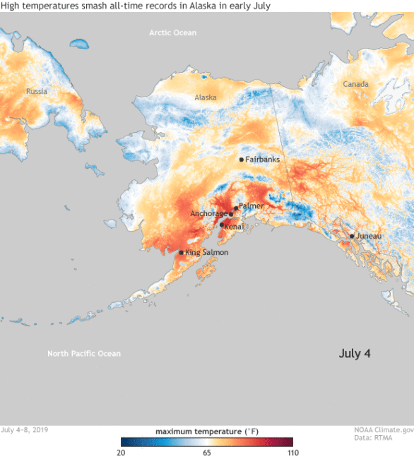
NOAA Climate.Goc has published details of the record breaking temperatures currently being measured in Alaska under the title “High temperatures smash all-time records in Alaska in early July 2019“.
What they are reporting is not simply a few degrees above average, but 20 to 30 degrees higher than normal in some locations …
On July 4, all-time high temperature records were set in Kenai, Palmer, King Salmon, and Anchorage International Airport. The airport reached an astounding, for Alaska, 90°F, breaking the previous all-time record by 5°F! The average temperature in Anchorage during summer is normally in the mid-sixties. Anchorage, Talkeetna (which saw a July record daily high of 93°F), and King Salmon also observed their warmest week on record.
And the anomalous Arctic heat has not been short-lived. Through July 10, Juneau saw the high temperature reach at least 70°F for a record 17 consecutive days. In Anchorage, the highs have reached 80°F for a record six consecutive days, doubling the previous record. And three of those days broke or tied the previous all-time record! The average high temperature from June 27 through July 8 was nearly 81°F, 5.5°F higher than the previous 12-day record. There’s out of the ordinary, and then there is what has been happening in Alaska.
Warmer than average can happen
Extremes do happen, and have happened in the past. Warmer than average is something that Alaska will experience when El Niño conditions are present in the equatorial Pacific. Current conditions in the Pacific do not explain this current record-breaking event. The climate is changing …
since the 1950s, Alaska has been warming twice as fast as the global average, according to the Fourth National Climate Assessment. Since the late 1970s, the statewide annual average temperature has being increasing a rate of 0.7°F per decade. And starting in the 1990s, record-high temperature have occurred three times as often as record lows. Simply put, record-breaking high temperatures across Alaska are not uncommon nowadays.
The Heat Dome
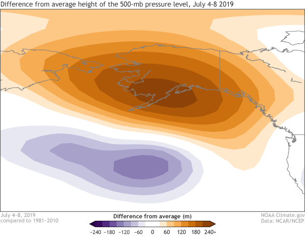
The current conditions are the result of a dome of high pressure that is sitting over the region …

The higher pressure keeps the clouds away and so temperatures rise.
The bigger picture is one in which the Arctic sea ice extent is shrinking. Lack of sea ice exposes a darker ocean that absorbs the energy from the solar radiation that would normally have been reflected. This in turn leads to change, and so we have an Artic where things are changing rapidly. Net effect is that the ocean and atmosphere and now also interacting a lot more.
Other Symptoms – Wildfires
Hot and dry means more wildfires.

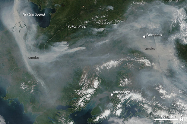
Smoke from those fires has been drifting across population centres, and so this has also happened …
…the first ever dense smoke advisory for Anchorage and some of the worst air quality in the world in Anchorage and Fairbanks. The smoke has made it difficult for the many people to cool off: air conditioning is rare, and opening the windows is a nonstarter.
Implications
The essence of it all is this – what we have here is one more data point that marks a position on the Global Warming journey we have collectively embarked upon.
We can still make decisions that will alter the outcome, but the window of opportunity for that is fast closing.
Further Reading
- The NOAA report on what is happening can be found here.
