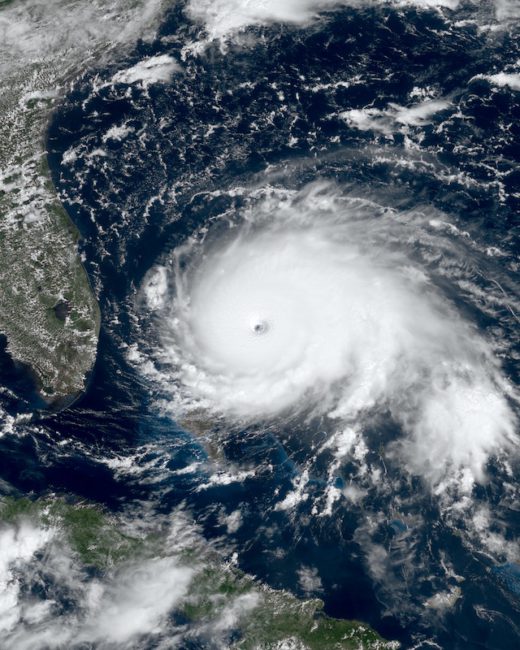
Penn State University issues a Hurricane Season forecast at about this time each year. the 2020 Forecast is now available.
You will find their 2020 Forecast here.
It is worth paying attention to it. Their forecast is for a rather large number of Hurricanes in just the Atlantic.
It is the largest number they have ever predicted.
What is the 2020 Forecast?
The prediction is for 19.8 +/- 4.4 total named tropical cyclones, which corresponds to a range between 15 and 24 storms, with a best estimate of 20 named storms.
Who worked on this Forecast?
ESSC scientists Dr. Michael E. Mann and Daniel J. Brouillette and alumnus Dr. Michael Kozar.
This is their seasonal prediction for the 2020 North Atlantic hurricane season. That season officially starts on 1 June and runs through 30 November.
How exactly did they create this Forecast?
Their prediction was made using the statistical model of Kozar et al. (2012, see PDF here). This statistical model builds upon the past work of Sabbatelli and Mann (2007, see PDF here) by considering a larger number of climate predictors and including corrections for the historical undercount of events.
The assumptions behind this forecast are (a) the persistence of current North Atlantic Main Development Region (MDR) sea surface temperature (SST) anomalies (+1.1 °C in early to mid-April 2020 from NOAA’s Coral Reef Watch) throughout the 2020 hurricane season, (b) the development of mild El Niño-Southern Oscillation (ENSO)-negative conditions by boreal late summer and early fall 2020 (ENSO forecasts here; we used mid-April 2020), and (c) climatological mean conditions for the North Atlantic Oscillation in boreal fall/winter 2020-2021.
If no La Niña develops, then the prediction will be slightly lower: 18.3 +/- 4.3 storms (range of 14-23 storms, with a best guess of 19).
Using an alternative model that uses “relative” MDR SST (MDR SST with the average tropical mean SST subtracted) in place of MDR SST yields a considerably lower prediction (13.6 +/- 3.7 total named storms). This alternative model also includes mild ENSO-negative conditions.
How Accurate has their Forecast been in Previous years?
They have been issuing this since 2007, so we can look back to compare the forecast and see how well they did.
Previous Forecasts:
| Year (click to see forecast) | Prediction | Best Guess | Range | Actual Count |
|---|---|---|---|---|
| 2007 | n/a | 15 | n/a | 15 |
| 2009 | 11.5 +/- 3.4 | 12 | 8-15 (6-13 if El Niño) | 9 |
| 2010 | 23.4 +/- 4.8 | 23 | 19-28 | 19 |
| 2011 | 16.25 +/- 4.0 | 16 | 12-20 | 19 |
| 2012 | 11.2 +/- 3.3 | 11 | 8-15 | 19 |
| 2013 | 16.0 +/- 4.0 | 16 | 12-20 | 14 |
| 2014 | 9.3 +/- 3.0 | 9 | 6-12 | 8 |
| 2015 | 6.9 +/- 2.6 | 7 | 4-10 | 11 |
| 2016 | 18.9 +/- 4.4 | 19 | 14-24 | 15 |
| 2017 | 15.3 +/- 3.9 | 15 | 11-20 | 17 |
| 2018 | 10.2 +/- 3.2 | 10 | 7-13 | 15 |
| 2019 | 10.1 +/- 3.2 | 10 | 7-13 | 18 |
Climate Change?
There are of course seasonal variations. However, the reality of the world we live in is that Hurricanes are basically driven by heat from the ocean. In a warming world heating up the ocean has a rather predictable result.
Hurricanes – Further Reading
here are a few of my previous postings …
- Nov 2019 – Is Intensity of Hurricanes increasing?
- Sep 2019 – Did Climate Change cause Dorian?
- Aug 2019 – Can you really Nuke a Hurricane?
- Feb 2019 – Climate Change: Hurricanes are strengthening faster
- Oct 2018 – Five Category 4+ tropical cyclones have struck U.S. soil in 14 months.
- June 2018 – Hurricanes are slowing down and that’s bad – #Climate
- Sep 2017 – James Hansen: Clear Link Between #Climate Change & Stronger Hurricanes
- Sep 2017 – Does Climate Change really Impact Hurricane intensity?
- Sep 2017 – Do we now need a Category 6 for a Hurricane?
- Nov 2016 – Climate Change: The intensification of super typhoons
